Free Printable USA Maps for Every Need
Our collection of printable USA maps provides high-quality, printer-friendly resources for education, reference, presentations, and more. All maps are carefully designed for optimal printing clarity and are available in both A4 and US Letter paper sizes to accommodate users worldwide.
Each printable USA map is optimized for both color and black-and-white printing, with clear text, distinct boundaries, and high contrast to ensure readability even when printed on standard home or office printers. Our PDFs are compressed to minimize file size while maintaining print quality.
Printable USA Map Collection
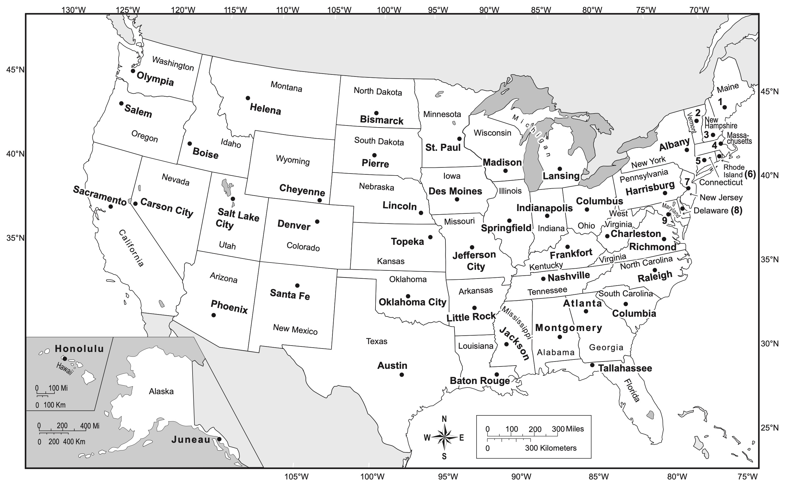
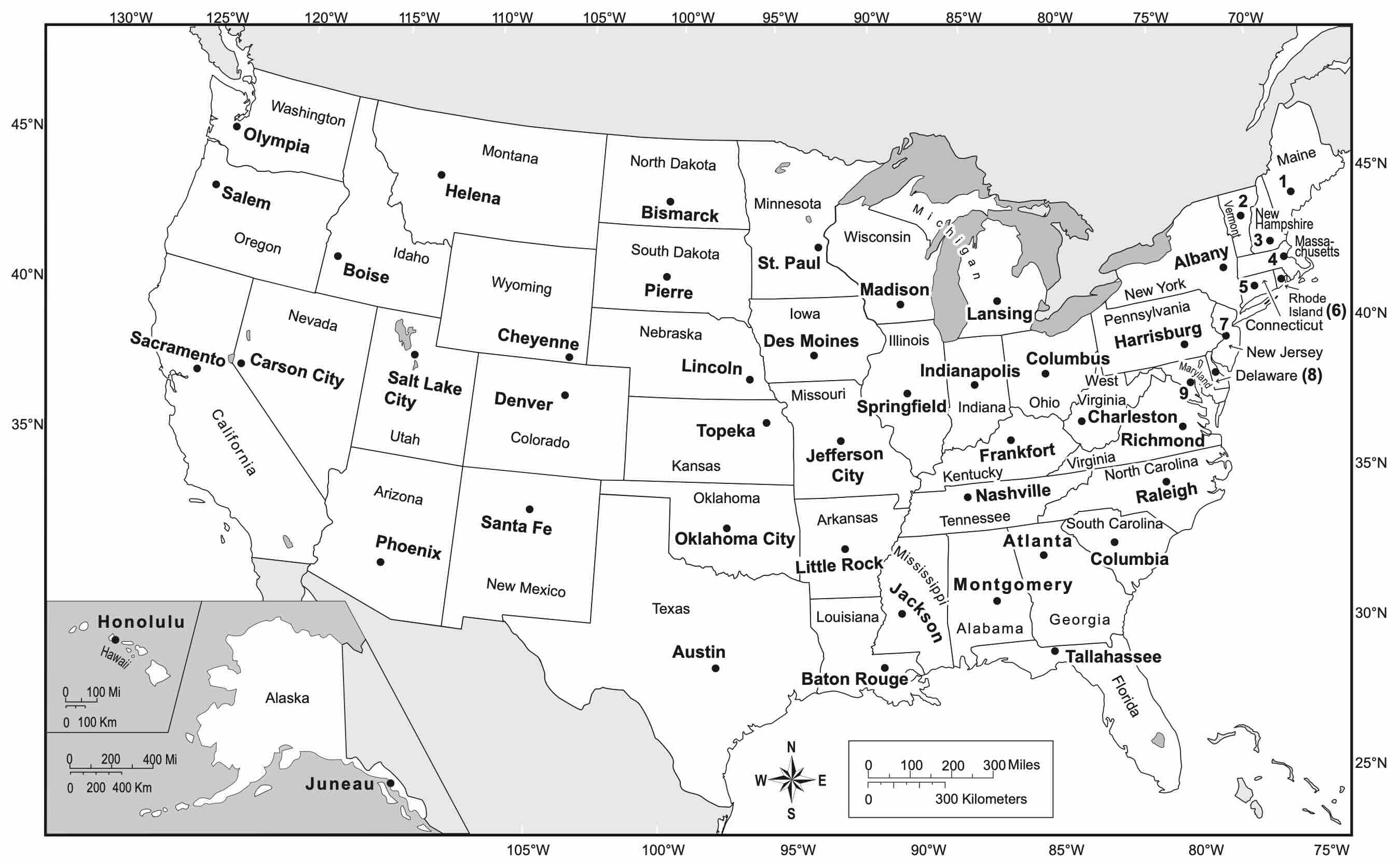
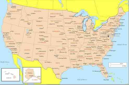
USA Map with States and Capitals
Complete labeled map showing all 50 states and their capital cities.
USA Map with State Names
Clear map showing all states with names but no capitals marked.
Blank USA Map
Clean outline map with state boundaries but no labels.
USA Map with States and Cities
Detailed map showing states, capitals, and major cities.
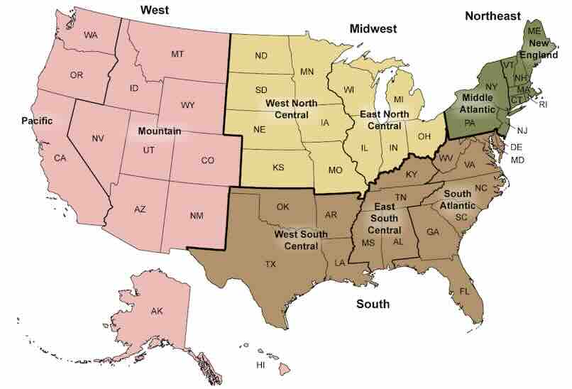
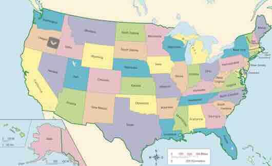
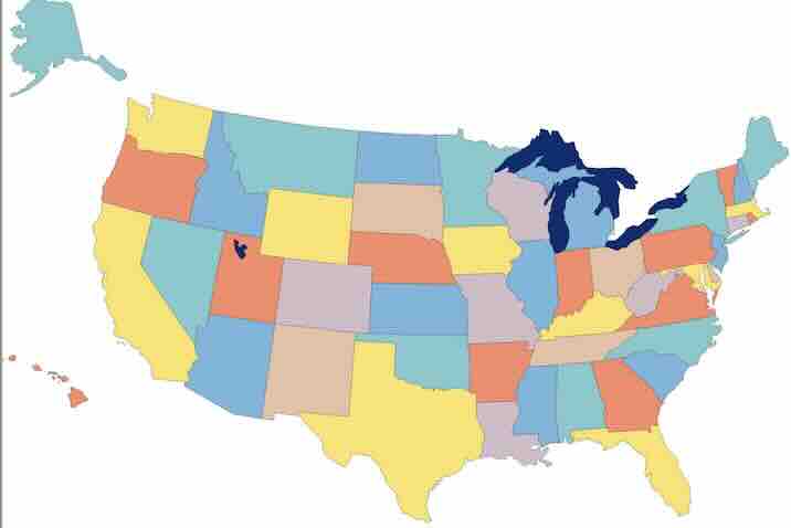
USA Map with Regions
Color-coded map showing the major geographic regions.

USA Physical Features Map
Map highlighting major mountains, rivers, and lakes.
Tips for Printing USA Maps
Printer Settings
For best results when printing our USA maps, use these recommended settings:
- Paper Type: Standard copy paper (20-24 lb / 75-90 gsm) works well for most uses
- Print Quality: "High" or at least 300 DPI for best detail
- Scaling: Set to "Fit to page" or "100%" depending on your preference
- Color Settings: Use "Color" for colored maps, "Grayscale" for black and white versions
- Orientation: All our maps are designed in landscape format
For Teachers and Classrooms
Educational tips for using our printable USA maps:
- Print multiple copies of blank maps for student practice
- Consider laminating maps for reuse with dry-erase markers
- Print on cardstock for map activities that require durability
- For younger students, choose the simpler maps with larger text
- Use different map types to teach various aspects of US geography
Paper and Preservation
For long-lasting maps or display purposes:
- Use acid-free paper for maps you want to preserve
- Consider printing on glossy photo paper for display maps
- For wall maps, have them professionally printed at a larger size
- Store flat or rolled (not folded) to prevent creasing
- If framing, use UV-resistant glass to prevent fading
Educational Activities Using Printable USA Maps
Elementary School Activities
Age-appropriate activities using our printable USA maps:
- State Coloring: Use blank maps for coloring exercises
- Match Game: Cut out state shapes and match to outline maps
- Regional Grouping: Color-code states by region
- State Symbols: Draw state birds, flowers, or other symbols on maps
- Famous Landmarks: Mark well-known landmarks on USA maps
Middle School Activities
More challenging geography exercises:
- Capital Quizzes: Label all state capitals on blank maps
- Population Mapping: Shade states based on population density
- Agricultural Products: Mark major agricultural products by state
- Historical Timeline: Color states based on when they joined the union
- Weather Patterns: Track and map weather systems
High School and College Activities
Advanced geographic analysis:
- Electoral College: Analyze electoral votes by state
- Demographic Studies: Map population, income, or other statistics
- Economic Data: Chart GDP, industries, or economic indicators by state
- Environmental Issues: Map climate change impacts or environmental concerns
- Transportation Networks: Analyze major highways, railways, and airports